Trip Report 2009 Days 1 – 7Saturday, Jan 09, 2010 at 18:12
Richard Kovac |
|
|
Holiday
25th May – 7th June 2009 5385.7 km Avg 7.15 Km/L Cheapest Fuel $1.199/L @ Kewdale, Dearest $3.20/L @ Kunnawarritj Avg. $1.7258/L No damage to the Troopy No flat tyres No problems at all This was our first trip was without our dog Benny who’d died a month or so earlier. It was to cover the Hunt Oil Road, the Gary Highway, Gary Junction Road, Sandy Blight Junction Road and abandoned section of the Gunbarrel Highway. Total water taken was 105litres and used a total of 65litres.  Trip
Day 1 – Monday May 25th.
Laverton Caravan Park Tyre pressure was front 40 and rear 50. Day 2 – Tuesday May 26th
Tjukayirla Roadhouse
to fuel up at 1330 and got some lunch at the same time. There was road works on the Great Central Road and along with a few rockholes and sights we saw camels and a few kangaroo’s.
Mick O’s camp
The ridge was about 10ft high with many eroded “caves” that animals would normally utilise. This time we’d brought along a portable toilet and tried it out with success. Day 3 – Wednesday May 27th
Hunt Oil Road
Road base is fairly good but surface varies between firm sand and small stones, some corrugation patches, dry spinifex and lots of dry creeks and gullies. As the spine fix increased we got out the home made shield for the radiator and did regular inspections under the vehicle. These inspections did not yield too much as there had obviously been two vehicles on the track at some recent point ahead of us.
Bore with pump
and then around 1200 we got to the caves. We thought about going to the abandoned camp but the washouts were too deep at the commencement that we thought we’d cut our losses and not proceed. We had a look around the caves and got lunch ready to have. We travelled on and at 1500 made Mt Worsnop and then onto Alexander Springs.
Alexander Spring
It was a warm afternoon when we walked up to the springs that were unfortunately dry. The remains of a dead camel (a long time dead as no smell) was just below the springs so can only assume they had been dry for some time.
Mt Worsnop
We headed back to junction of the road and turn off to Alexander Springs and set up camp for the night. At 1640 it was still 20°C. Toilet breather had leaked the cleaning solution and a branch had loosened one of the diesel jerry can lids (but didn’t loose fuel as we saw the wet patch around the mouth) but otherwise no ill effects from the road. Richards hip still holding up but giving Richard stabbing pains and he got through on the HF sched to give a progress report. Day 4 – Thursday May 28th
Caterpillar Train
We got out to watch these curious creatures marching up the sides of the road. We then had a camel escort us up the road for a short time and then a bustard (or bush turkey)
Bustard Escort
did the same thing a short way later. 1015 we had morning tea at the potentially good campsite and at the Nissans burnt remains we learnt that the Williams clan travelled the Hunt Oil Road on the 22 may 09 (also from Perth). We got to Geraldton Bore at 1430 and set up camp. We’d also realised that day that the following Monday was a public holiday in WA so the planned stop for fuel would be closed. Richard tried to ring Kunnawarritj but got an answering machine. While the afternoon was still warm (22°C) and we had bore water available, Richard tried out the portable shower. Hanging some bits off the ladder and standing in a blue bowl we used to carry bulky items he had a shower and washed his hair which once becoming accustomed to the cool temperature was enjoyable. Robyn and already had a cloth wash so declined the offer of a shower. Lessons learned included not to stand so close to the Troopy.
Geraldton Bore Camp
About 1600 we saw a 70 Series Ute heading east on the Gunbarrel but didn’t stop. That evening Richard again made the sched but lightening could be seen clearly and plentifully in the east, the sched was not able to shed any light on the weather being a problem. The south/western sky was still clear and we practiced how to find south using the southern cross. A new moon rose to the north. Day 5 – Friday May 29th
One to DEC (Department of Environmental Conservation) as they had a sign saying they were planning burns during May June 09 and ring them, getting through and getting an all clear, the other to Kunnawarritj and while he got through couldn’t manage to speak to anyone. we visited Charlies Knob and found the stone compass on the ground, not further on we met 2 vehicles heading south (QLD & VIC) they had seen rain in patches and road still had puddles on it but not enough for them to issue warnings. They were heading to Kalgoorlie to visit family before heading back east. There were 2 individual vehicles heading north ahead of us.
Charles Knob
Around McPherson Pillar turn off there was big evidence of previous “bogs” and the area was muddy.
Boggy Hole
We made the turn off at 1500 and got to the Mulgan Rockhole at 1530 (this road was very rough & rocky) and then got to the Pillar at 1600. There was water in the Rockhole and camels nearby. Camped at McPhersons Pillar base and had a wonderful view of it, despite our concerns at the weather. After setting up camp we took a walk up to the pillar and saw rain clouds dropping rain to the north and clouds marble like overhead. Nothing we can do is wait and see what happens. We saw a “message in a bottle” hanging in the tree at the base of the pillar and we read a couple. Richard recognised one of the messages from an online correspondent “27/06/07 Allan & Jerry McCall left to visit Lake Blair & Alfred Marie Range”. Richard put the photos on the laptop and see saw where we’d been.
McPhersons Pillar Camp
Sounds of rumbles occurred around us but it sounded more like a plane in flight path rather than thunder. After the HF sched we listened to the Carlton vs. Eagles game which Carlton won. 🙂 Day 6 – Saturday May 30th
McDougall Knoll
We prepared lunch at McDougall’s Knoll (1245) where you drive up onto the knoll to the Trig marker. It would be possible to camp in ample area’s in the hinterland. Initially after McDougall’s Knoll the road was more rutted and slow but then opened back up into spinifex country some with many bushes and small trees. Many of these plants crowd the road and you find yourself in “avenues”. Flowers were out on most of the bushes but not masses on the ground. Some area’s of road showed evidence of ripples on the road, so the rain must have been enough to have run off. Animal life we saw that afternoon included the occasional camel, kangaroo and bustard.
Tropic of Capricorn
and soon after found an area suitable to make camp (1600). As we unpacked we realised the little aerial had been broken off, the large one we took off every day due to the plants overhanging the road. Setting up the tent we had the dew from the morning running off it.
Camp for the night
He stopped to chat and was a geologist who had worked this broad area for over 30 years and was heading to Leinster for Monday. We broke the bad news that it was a public holiday Monday and while irritated (like we had been) he could take the trip a bit more slowly. He told us something of the area ahead of us and headed off into the dark. We listened to the footy again that evening. Day 7 – Sunday May 31st
Next morning
We turned up the road the Patience Well and looked in on a rocky outcrop with caves at 0817 that would have been an ok for a camping spot and extended investigation would have been worthwhile (if time and weather permitted). There was a lot of evidence that animals used the caves (probably to get out of the “pea soup” mist).
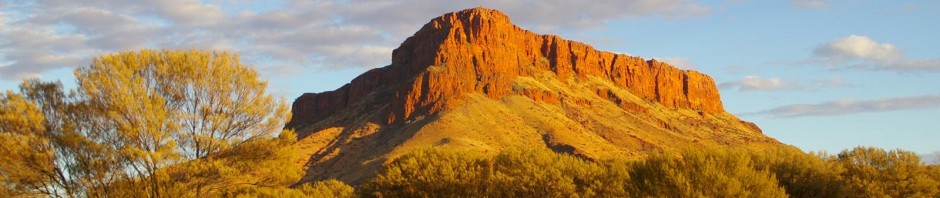
Gary Hwy
The country side kept changing from rocky outcrops and caves, natural bridge
Rocky outcrop and caves
and good quality camping in those regions for large crowds, to dense trees and then more open country. We did an off road excursion, to where we believed Patience Well was, but upon heading into what looked like a dense tree line doubled back to the track fairly disappointed. Tyre tracks headed off into the scrub SE where the track turned more to the North and we assumed this had been the geologist we met last night. We however turned back to the Gary Hwy and got back to the junction at 1125. 55 mins up the road we turned off to Well Number 2. It was a pretty drive about 3 km up the road you pass through an avenue of wattle (very overgrown) but quite pretty all the same. This 47km stretch of track had some loose, soft sections but was otherwise in fairly good condition. Got there at 1140, made lunch and had a look around. No 2 Well was opened in 2000 and closed in November 2003 and was >4km in depth!! 
Patience oil Well
The pump looked to still be there and had the plaque with information on it. There were still plenty of old drums, tins, cement blocks, and old rubbish tip, bits of old tanks and the Aerodrome had white tyres and tins in large drill rod thread protectors to light it up when needed. Worth the longish trip out we thought and headed back, making it to Gary Hwy again at 1457. We heard a couple of vehicles on the Gary Hwy as we were about to turn back onto it, but didn’t see them (only their tyre tracks). We thought we’d make camp at Veevers Crater and headed out missing a large lizard (most likely a monitor) in the grass off the track. This track had some large washaways that had be detoured and mostly grass with some low scrub.
Veevers Crater
Reached the crater at 1540 and it was ~70m across and 5 m deep. There was no where to camp there so after a hurried look we headed back to try to find a camp. Just prior to the Gary Hwy turn off there was a cluster of and nestled with them for the night.
Camp with the Ghost Gums
Richards’s leg was very bad tonight but he did miss the lunchtime voltaren. We had been camping in an L shape with the tent off the side of the drivers side rear of the vehicle on the ground sheet tonight we tried another option. We put out the awning at the back of the Troopy and the ground sheet under it with tent in line with the end of the awning. Pro’s being easier to unpack (and under cover) and having clear access to both sides of the vehicle, con’s being awning in the road of gas bottles on the roof (had to use ladder up the side) and because we put the tent on the ground cover we were fairly close to the back of the Troopy and therefore a bit cramped. We took the table and chairs outside initially. Words by Robyn and Richard Kovac R2K All Photos and other Blogs can be seen and read @ https://profile.live.com/cid-e092a94edb141da4/#!https://skydrive.live.com/?cid=e092a94edb141da4&sc=photos |
|


Recent Comments
Richard & Robyn… on Oz Travel Map 2000 to 201… Lance on Oz Travel Map 2000 to 201… Richard & Robyn… on Oz Travel Map 2000 to 201… Lance on Oz Travel Map 2000 to 201… Richard on Avascular necrosis
