Holiday
14th August – 11th September 2006 9296.4 km
Avg 6.68 Km/L
Cheapest Fuel $1.379/L @ Seymour, Dearest $1.773/L @ Border Village
Avg. $1.4996/L
No damage to the Troopy
No flat tyres
No problems at all
Van fell apart
We had bought an off road caravan earlier in the year and took possession of it on 24 June 2006 so planned a trip to Victoria that would test it out. Richards father had died 4th December 2005 and we thought it fitting to visit the family to see how they all were. We needed to go fairly quickly to Victoria (due to other family travel arrangements), thus planned to meander on the return trip to see different countryside that was not too rugged.

Day 1 – Tuesday August 15th.
The day was overcast and spitting rain when we left Bruce Rock (BK) at 0800. We arrived at Merredin at 0840 where we fuelled up at 0840 and left by 0900. The odometer on the Toyota Troop Carrier BLR 369 at this point was 77,044km. Tyre pressure was front 40, rear & caravan all 60.
At 1045 watered and walked Benny around the old building opposite Yellowdine Roadhouse and again for lunch at Coolgardie parkland between 1230 & 1300. We had difficulty closing the pop up on the caravan due to the windy conditions and amidst a dust storm continued onto a scenic trip around Kalgoorlie and Kambalda.
Entering Norseman at 1600 it was now raining heavily and we were starting to regret our leisurely drive around Kal so checked out the local caravan park. They were ok with pets so once we knew Benny was welcome we paid our $23.50 and stayed for the night (instead of our planned camp at the Fraser Ranges 24hour rest stop). We had set up the caravan by dusk (1730), established that we needed a longer power cord and enjoyed the luxury of flushing toilets for the night. Richard enjoyed the hospitality of fellow travellers and invited into their c’van asked about various issues related to caravanning (including the questions about battery systems). Arriving back at our van we commenced cooking to set off the smoke detector for the first of several times. Richard had discovered the laptop was within range and got the internet. We therefore planned our next nights camp thanks to a wonderful website http://www.### that told you how many paws a caravan park was. We had a comfortable nights sleep as the evening continued to be cool and the rain had settled down to drizzle after the first heavy downpour.
Day 2 – Wednesday August 16th
Waking up at dawn (0600) to cool, clear skies we started to break camp. By 0730 we’d fuelled up and left Norseman. We had an uneventful morning, taking note of our planned nights rest-stop some 79km outside Norseman, and after putting the clock forward 45 minutes pulled into Cocklebiddy for lunch at 1300. the day continued to remain cool and fine and again with the threat of light rain we pulled into Eucla Service Station at 1700, where we paid the $18 for a powered site at the Caravan Park. Again we could get internet access which surprised us.
Day 3 – Thursday August 17th
Up early, we awoke at 0500 to a very overcast day that continuing to rain on and off all day. We fuelled up at 0600 at Border Village and continued on our way within 30 mins.
Stopping at Penong around 1100 we broke for lunch and then again put the clock forward 45 mins. Arriving at Kimba early afternoon (1600) we fuelled up and paid for a powered caravan site ($17 and $10 deposit on the key). We took a walk into and around the town before getting back into the routine of cooking, eating, reviewing relevant websites and information for the next day, etc.
Day 4 – Friday August 18th
Up at 0630 it was again an overcast day with intermittent rain. We had to wait until 0730 for the roadhouse to open if we wanted to recoup our deposit and then headed off at 0745. By 0900 we were taking a leisurely drive around the town site of Iron Knob. At Peterborough we attempted to catch up with internet colleagues of Richards. They however were in Pt. Pirie so we arranged to drop in on the return trip. We left around midday via Morgan to Burra and down along the Murray, crossing by Ferry at Cadell, onto Berri. We set up at the caravan park ($22 with $10 deposit for the dog), a lovely spot on the river and strolled along the tourist river walkways.
Day 5 – Saturday August 19th
Cold and fine at 0600 we leisurely organised ourselves for the final day of this leg of the trip. Heading off from Berri Caravan Park at 0800 we travelled the Calder Highway, fuelling up at Sea Lake (worrying that we would not find anything open and turning the clock forward another 30mins) we got to Broadford ~1700.
Settling the caravan on the unsteady ground took up the first hour of arriving at Richards Mum’s. Richard had a quick visit to the pub to catch up on local gossip/news than back home for tea.
Day 6 – Sunday August 20th
Up late and got ready for the BBQ at Veronica and Noels. Another fine and cool day is was very pleasant for sitting out on the back veranda of their new extension to eat lunch. Janine, Chris, Samuel and Alexandra came up at about 1100 with Chris and Samuel heading off to Melbourne to look at some uni’s. Went to Veronica & Noels at 1200 for the BBQ, Jean and Keith Oliver were already there and we met Major (the Dalmatian). We looked at the big trip to Yugoslavia, Italy etc with the Keast and Mum. Samuel and Chris came back from Melbourne about 1730 and with a dog poo getting trampled inside on a shoe we left. The new extension was really lovely with a large sitting room, kitchen, bathroom/laundry and back veranda. The Keats left for Benalla about 2030, while we stayed up late talking.
Day 7 – Monday August 21st
The day was very overcast and cool so ideal for having a lazy day watching video’s, booking the car into Seymour for it’s service on Thursday. Richard was very sick after a big day at the BBQ.
Day 8 – Tuesday August 22nd
Drizzling with rain initially then became fine. Richard still feeling a off colour but we went for a drive around Broadford and local region between 1000 – 1200. Went to the pub for about an hour at 1830 and then visited Veronica and Noel, saw the NZ trip photo’s.

Day 9 – Wednesday August 23rd
Today the weather took turns alternating between fine and overcast. Drove into town to the caravan place and up Mount Disappointment past the dam. Then on past Strath Creek Falls, Murchison Lookout and generally drove around. Had a quiet night at home.

Day 10 – Thursday August 24th
Up at 0700 we headed off to Seymour in 2 cars to get the Troopy Serviced. Then took the other car (Mums) up into the highland via Yea, Strathbogie, Euroa and back to Troopy. Did some shopping, fuelled up and then back to Broadford and spent the afternoon at home.
That evening Ray, Marie, Sue, Yasmin and Max came up from Melbourne for tea. Veronica and Noel came up. Not everyone could fit at the table, so Mum and I sat in the lounge. Dick rang up and spoke with Richard. Lovely night had.
Day 11 – Friday August 25th
Had a quiet morning and then walked Benny to the shops. Later in the afternoon we drove up to Benalla via Flowerdale, Yea and Bonnie Doon. Arrived at Chris & Janine’s at 1730 had a good look around the garden. Had Pizza and then Dutch Jaffles. Benny disgraced herself by breaking into the dry dog food in their garage and gorging herself. Left about 2330 and arrived back in Broadford about 0100.
Day 12 – Saturday August 26th
Quiet morning, Benny up several times overnight. mid afternoon we drove out to Lavender farm but it was closed, so we took a drive around the Hells Angels property. Had a visit to the pub between 1730 – 1900 when we went back for tea. Should have gone out again as arguments ensued on and off more this night than usual. Eventually is peaked and we packed up and left at 0100.
Day 13 – Sunday August 27th
0300 we arrived outside Janine & Chris’s place at Benalla. Parking in the street so we could keep the driveway clear (Janine was working at 0700 at the hospital). We rose late and then around midday took a walk around the lake and river. Janine came home about 1330 for lunch, then Alexandra & I (with Lucy and Benny) took a walk to the video shop to get Firewall (with Harrison Ford) to watch that evening.
Day 14 – Monday August 28th
Another fine day (with a cold wind) we got up at 0700 and saw Chris, Janine & Alexandra off to work & school, Samuel had a day at home to study. We left Benalla at 1000 via Shepparton, Echuca and had lunch at Deniliquin ~1300. We got into Hay mid afternoon and after a quick drive around town, fuelled up, did some shopping, found the dog friendly caravan park, paid our $20 and set up camp around 1430. The man who showed us our site by bicycle was lovely and very chatty, he and Richard had a lengthy conversation about travelling, computers etc. Enjoying a warm afternoon we sat outside the caravan until dusk, enjoying reading and watching fellow travellers set up camp. We washed some clothes and once it got cooler moved inside to cook and read.

Day 15 – Tuesday August 29th
Up at 0730 to a fine and warm morning, we left the van park at~0830. The Hay Plains are expanses of grassy plains with no trees unless they’re at homesteads. We stopped to get lunch at Ivanhoe around 1130 and then finally got to the business of testing out the “off road” value of the Supreme Getaway Caravan. The road to Menindee basically followed the railway line and was in reasonable condition but with corrugations. We came into Menindee at 1530 to various types of orchards & wineries. We crossed the Darling River, having to slow down for the goanna waddling across the road, and drove around the town, called into the information centre and then out to the historic woolshed, past the dry Menindee Lakes and out to Copi Hollow (one of three Caravan Parks). During the drive we experienced Blue Tongue Lizards, Emus and corrugations in abundance. Copi Hollow is actually the Broken Hill Speedboat Club and for $18.50 you get a powered site on a lovely spot on the lake. This lake is dammed water from the Darling River, all the natural lakes are all now dry.
Upon opening the van door we discovered that the cutlery draw was the only casualty of the woolshed loop road. The catch had broken resulting in the draw and it’s contents spewing all over the place. Richard used the catch off the “false” door under the sink to fix it, we wrapped up the contents to prevent some of the “jiggling”.

Richard enjoyed a fire with the man from the caravan next door (from Bendigo) and another man and his grandson who stayed in a cabin. They were pest controllers from Renmark who did regular trips to Broken Hill & White Cliffs because it was difficult to get others willing to come out to the remote areas.

Day 16 – Wednesday August 30th
Another fine and warm day greeted us as we rose at 0730 and leaving 1 hour later we headed off to weir via the scenic road around the lake (again very corrugated and slow). There were many dead trees in the water and swimming warning signs were posted around the lake, because of the lake depth the water was very cold when you got in deeper. We then headed off to Broken Hill, the road following the water pipe and railway line. Taking a quick drive around Broken Hill we fuelled up and at 1030 we took off to South Australia, stopping at Yunta for lunch at 1300. We noticed the caravan windows had been working their way open, so realised we had not secured them properly.
Getting to Peterborough at 1400 we enjoyed a pleasant afternoon and evening with Judith & Willem Kempen, able to catch up on more washing. Their garden is lovely and being able to sit outside and bask in it was lovely. Judith is a painter and Willem a brilliant writer, keeping many on various 4WD internet sites entertained with his ventures. The roast dinner was nearly surpassed by the homemade prickly pear sauce over ice cream.

Day 17 – Thursday August 31st
Laden with Judith’s homemade jam and chutney we left for the Peterborough Art Gallery (where Judith and Willem are heavily involved and basically run). We viewed the exhibition on display and after buying a painting, a wooden painted “welcome” sign and some hand made cards we headed off at 1130 into the fine warm day. We had been told to calling into the “old gum tree” at Orroroo, situated a few metres off the highway it was truly amazing. We called into Pt. Augusta to see if we could find a place that might sell a latch for the broken draw catch. After much manipulation of streets and suburbs we came away empty handed and headed off again. We stopped again at Kimba Caravan Park and fuelled up at the roadhouse where we also paid our dues. Richard spent time talking to the family next door. They had Mother, Husband, Wife and several children. From WA they had been travelling about Oz and now heading home.

Day 18 – Friday September 1st
Up at 0730 we packed up and left at 0800. We had decided to tour through the Gawler Ranges National Park, which once we got there via a very poor road, was very nice. Good roads but unable to get out as National Park and we had the dog. Would have liked to see the Pipes but didn’t see the turn off so missed it. Got to Minnipa for lunch then back to the highway. Caravan stood up to it ok.

Got to Ceduna and fuelled up at 1500 and then headed to Fowlers Bay. Got there about 1730 and got a spot at the caravan park for $21 (pensioners rates we were given) and enjoyed a walk around the pier and town. Spent a bit of time talking to a couple from Ceduna. They had taken a year off and had been travelling for 19 weeks and their 2 dogs.

Day 19 – Saturday September 2nd
Overcast and cool again we got up at 0700 and walked around the Jetty. Leaving at 0830 we went to the Head of the Bight. For $10/head we went in with the other tourists so see many whales off the bight.

The walkways were full of people who like us were in awe of these fabulous mammals meters away from us. From here we found our way onto the old Eyre highway.

On this stretch of road we saw a Dingo several meters off the road and a family of shot camels. We got to Koonalda at 1400 and took a good look around.

Homestead made out of railway sleepers its been deserted for over 30 years with an old petrol pump and multiple abandoned buildings. Further up there are caves but we didn’t have time and with the caravan not sure we’d able to turn around. We passed a vehicle on the road (from NT) and saw some blowholes, just as it started to rain.

We got into Border Village as the rain became heavier, fuelled up, got through quarantine and again headed for the Eucla Caravan Park ($18). Due to the rain we settled into the van for a quiet night.

Day 20 – Sunday September 3rd
Up at 0700 to and cool and overcast day we left at 0800 and turned the clock back 90 mins. At midday the day became fine and warm and we had an uneventful day making good progress. At Balladonia (there was much roadwork’s) but it had been raining so we thought it unwise to head down to Esperance and kept heading west. We fuelled up at Norseman and then back via Great Eastern Highway to Bruce Rock at 2200.
Day 21 – Monday September 4th
Cool and wet we spent the day cleaning out the caravan and outside of the car, weeding, mowing, whipper snipping and washing clothes. Richard spent the evening at the club.
Day 22 – Tuesday September 5th
Fine and cool today but very windy. Cleaned the outside of the van, washed all van rugs, linen etc. Richard separated the front reticulation into 3 lines instead of 2 resulted in better pressure, he put up the “Welcome” sign we bought at Peterborough. Robyn did some cooking while Richard was at the club.
Day 23 – Wednesday September 6th
Weather continued more of the same. Pest control man came at 1200. Cleaned the Troopy and repacked both the troopy and van. Richard did repair work to the van and Robyn weeded the back yard. We reset the retic times and Richard headed to the club again.
Day 24 – Thursday September 7th
Overcast, raining, cool and very windy. Went into Merredin and bought some plants for the front yard. Prepared the back half of the house for painting. Gouged out flaky plaster and filled in holes/cracks. Richard, to the club for the evening.
Day 25 – Friday September 8th
Painted the back entry, toilet, laundry and back room. Went to the club for tea, Robyn left and Richard stayed on.
Day 26 – Saturday September 9th
Went to see the Bruce Rock Show (our 2 year anniversary of having the house). Returned all equipment into back rooms. RDK to club.
Day 27 – Sunday September 10th
Back to Perth and fuelled up.
Words by Robyn
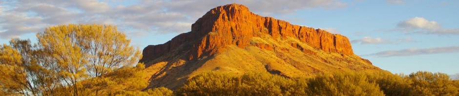
Photos by Me
P.S. we miss Benney


 Leaving Leinster at 1425 we travelled down the highway stopping at the many spots on the return journey,


")
")


